-
 Subscription or Perpetual based license
 -
 QPS TTL/ZDA Splitterbox MK3 (8-way) 19" Rack Mount
 -
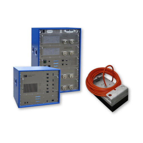
Included Features
- 24-bit SLF full waveform data acquisition / Innomar "SES3" data format
- Multi-ping mode for maintaining a high pulse rate in deep waters
- Multi-frequency signals
- SESWIN basic remote-control via COM / UDP (e.g. line start/stop, line name)
-
Included Features
- 24-bit SLF full waveform data acquisition / Innomar "SES3" data format
- Multi-ping mode for maintaining a high pulse rate in deep waters
- Multi-frequency signals
- SESWIN basic remote-control via COM / UDP (e.g. line start/stop, line name)
-
Included Features
- Heave / Roll (or Pitch) beam stabilization
- 16-bit SLF full waveform data acquisition (sub-bottom data) / Innomar "RAW" data format
- 24-bit SLF full waveform data acquisition / Innomar "SES3" data format
- Multi-ping mode for maintaining a high pulse rate in deep waters
- Multi-frequency signals
- LFM chirp (5 – 15 kHz)
- SESWIN basic remote-control via COM / UDP (e.g. line start/stop, line name)
- external AC power adapter (100–240 V AC)
-
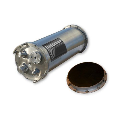
Included Features
- Heave, Roll and Pitch beam stabilization
- 24-bit SLF full waveform data acquisition / Innomar "SES3" data format
- Multi-ping mode for maintaining a high pulse rate in deep waters
- Multi-frequency signals
- LFM chirp (full SLF band)
- Barker coded pulses for safe bottom track also in multi-ping modes
- Linear sub-bottom profiler / SBES echosounder mode (12/15/18 kHz CW and 12 – 18 kHz FM chirp pulses)
- Bottom slope control
- KVM extender for remote control
- SESWIN basic remote-control via COM / UDP (e.g. line start/stop, line name)
- Transducer frame with integrated shock absorbers for hull-mounting
-
Included Features
- Heave / Roll (or Pitch) beam stabilization
- 16-bit SLF full waveform data acquisition (sub-bottom data) / Innomar "RAW" data format
- 24-bit SLF full waveform data acquisition / Innomar "SES3" data format
- Multi-ping mode for maintaining a high pulse rate in deep waters
- Multi-frequency signals
- LFM chirp (5 – 15 kHz)
- SESWIN basic remote-control via COM / UDP (e.g. line start/stop, line name)
-
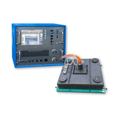
Included Features
- Heave / Roll beam stabilization
- 24-bit SLF full waveform data acquisition / Innomar "SES3" data format
- Multi-ping mode for maintaining a high pulse rate in deep waters
- Multi-frequency signals
- LFM chirp (3 – 12 kHz)
- KVM extender for remote control
- SESWIN basic remote-control via COM / UDP (e.g. line start/stop, line name)
- Transducer frame with integrated shock absorbers for hull-mounting
-
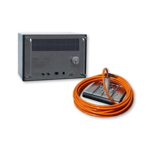
Included Features
- Roll or Pitch beam stabilization
- 24-bit SLF full waveform data acquisition / Innomar "SES3" data format
- Multi-ping mode for maintaining a high pulse rate in deep waters
- Multi-frequency signals
- LFM chirp (5 – 15 kHz)
- SESWIN basic remote-control via COM / UDP (e.g. line start/stop, line name)
- external AC power adapter (100–240 V AC)
-
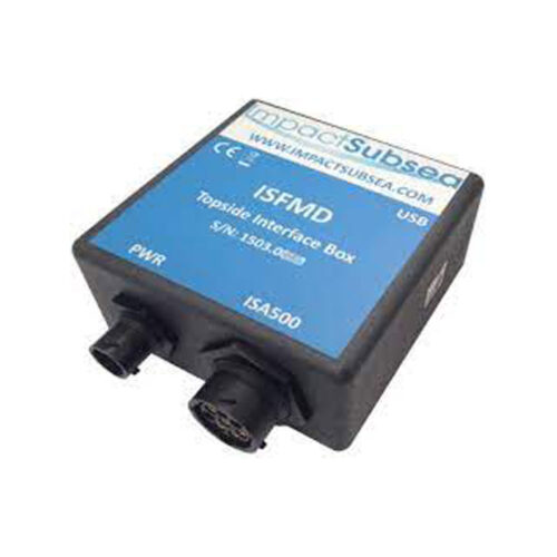 Impact Subsea ISFMD System Topside Interface Box
 -
 Impact Subsea ISFMD System Software License
 -
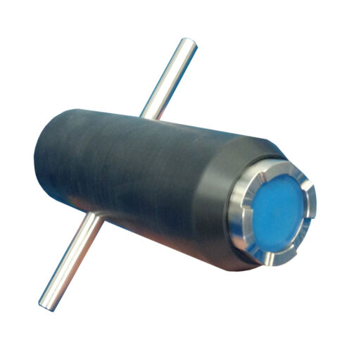 Impact Subsea ISFMD System ROV Only System ROV Only System
Contact us at +1 (706) 522-3022
TOP NEWS!
481 S. Jackson Street
Hartwell, GA 30643
Shop
Your account
Subscribe to our newsletter.
Join our emailing list to receive all up-to-date information from ECHO81
© Copyright 2016 - 2025 | ECHO81 | All Rights Reserved | Powered by ECHO81