 Parametric Sub Bottom Profiler Echo81")


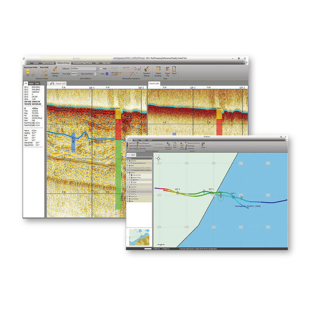
Innomar ISE Processing Software
Overview
- Processing of all Innomar data formats, including SES3 files.
- Handling of 16/24/32-bit and multi-channel data files.
- Similar “look’n’feel” as the Innomar SESWIN on-line control and data acquisition software.
- Intuitive handling of 2D data sections with free zoom levels and undo/redo.
- Project-based workflow, but can also be used to view/process single data files.
- Integrated GIS-browser builds the file handling base.
- GIS map synchronized with seismic section view (cursor, track cross-points, picked targets and ground-truth positions).
- Processed and interpreted data can be exported into various industry-standard data formats, including ASCII, DXF, 3D grids.
Description
Post-processing software with GIS module for Innomar specific data files.
Innomar ISE is the user-friendly post-processing software for all data acquired by Innomar’s parametric sub-bottom profilers.
A project-based workflow allows intuitive handling of 2D seismic sections together with a GIS map window. The processing includes signal filtering, noise reduction, tide and vertical corrections, cleaning of external sensor data, picking of seabed and sub-seabed reflectors and targets and the overlay of external probe and core data to assist interpretation.
Raw, processed and interpreted data can be exported to various industry-standard formats, such as SEG-Y, XTF and ASCII
Project-based Workflow
- Project tree with all files, such as seismic data sections, tide files, ground-truth data, picked leayers and targets, etc.
- Save/restore the processing status for individual data files and projects between sessions.
GIS Browser
- Handling of data in various coordinate systems and projections.
- Overlay of colour-coded bathymetry, sub-bottom layers, targets and ground-truthing onto charts, geo-referenced images and other GIS data.
- Calculation of crossing points between tracks and marking these positions in the 2D sections to assist quality assurance.
Processing of 2D Seismic Sections
- Processing of full-waveform and envelope data.
- Several visualisation modes and colour-mapping options.
- Various noise and spike removal filters.
- Options to correct gain, such as time-variable gain (TVG) and automatic gain control (AGC).
- Different options for (semi-) automatic bottom track.
- Corrections for vessel movements (heave, roll, pitch), tide/swell, static shifts and sound velocity.
- Picking and export of acoustic reflections from layers and targets.
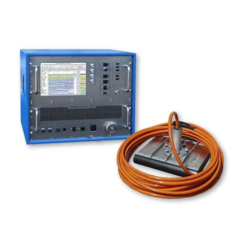 Innomar Medium-100 Subottom Profiler (Rental)