Related products
HYPACK GEOPHYSICS
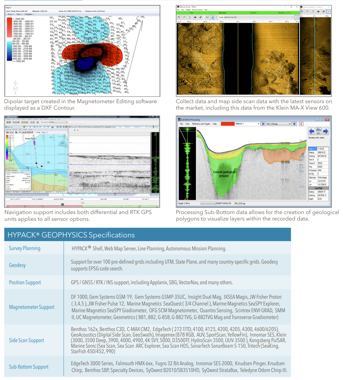
HYPACK GEOPHYSICS combines all of the tools required for geophysical surveys in a centralized, easy to use interface. GEOPHYSICS
supports side scan, sub-bottom and magnetometer survey planning, navigation, and processing, including interfaces for more than 30 devices. GEOPHYSICS includes search and recovery (SAR) survey and targeting tools. Collect and mosaic side scan data in real-time or in postprocessing.
Product Description
HYPACK GEOPHYSICS: combines all of the tools required for geophysical surveys in a centralized, easy to use interface. GEOPHYSICS supports side scan, sub-bottom and magnetometer survey planning, navigation, and processing, including interfaces for more than 30 devices. GEOPHYSICS includes search and recovery (SAR) survey and targeting tools. Collect and mosaic side scan data in real-time or in postprocessing.
HYPACK® GEOPHYSICS is provided to support the systematic collection of geophysical data for spatial studies. There are three types of devices used to collect geophysical data in the marine environment: Magnetometers, side scan sonars, and sub-bottom profilers. HYPACK® GEOPHYSICS supports data collection and post-processing for all three sensor types, allowing users to use one software package where survey data can be collated and compared.
Factsheet: Hypack Geophysics
CONTACT INFO
Have a question? Can’t find what you’re looking for? We’d love to hear from you!
Connect with us using the information below.
PHONE
+1 706-522-3022
ADDRESS
481 S. Jackson Street
Hartwell, GA 30643
Hartwell, GA 30643
At ECHO81, we believe in the power of collaboration and are proud to work alongside a network of exceptional partners who share our commitment to excellence. We work with EdgeTech, Kongsberg, Applanix, AML Oceanographic, and many more.
We are always looking for new ways to grow and improve. If you have any questions, feedback, or would like to learn more about how ECHO81 can assist you, please don’t hesitate to Contact Us