


SonarWiz
SonarWiz with other available options
Product Description
SonarWiz with other available options:
- SonarWiz ADD: Office Magnetometer
- SonarWiz ADD: Office Sidescan or Sub-bottom or Multibeam
- SonarWiz ADD: Office Single Beam
- SonarWiz ADD: Field Multibeam
- SonarWiz ADD: Field Sidescan or Field Sub-bottom
- SonarWiz ADD: Magnetometer or Single beam
- SonarWiz ADD: Sub-Bottom
- SonarWiz Field & Office DOES-IT-All Suite
- SonarWiz Field & Office Magnetometer
- SonarWiz Field & Office Multibeam, MBES & LiDAR interfaces
- SonarWiz Field & Office Sidescan
- SonarWiz Field & Office Sidescan & Multibeam
- SonarWiz Field & Office Sidescan & Sub-bottom
- SonarWiz Field & Office Single Beam
- SonarWiz Field & Office Sub-bottom profiler
- SonarWiz Field Mag
- SonarWiz Field Multibeam, all MBES & LiDAR interfaces
- SonarWiz Field SBP, analog & digital SBP interfaces
- SonarWiz Field Sidescan
- SonarWiz Field Sidescan analog & digital
- SonarWiz Field Sidescan, Multibeam, Sub bottom
- SonarWiz Field Single Beam standalone
- SonarWiz Field SS & SBP, analog & digital SBP interfaces
- SonarWiz Field/Field & Office w data collection
- SonarWiz Office Magnetometer
- SonarWiz Office Multibeam
- SonarWiz Office only processing
- SonarWiz Office Sidescan
- SonarWiz Office Sidescan & Multibeam
- SonarWiz Office Sidescan & Sub-bottom
- SonarWiz Office Single Beam or Mag
- SonarWiz Office Sub-Bottom Profiler
- SonarWiz Office Suite (SS, SBP, MBES, SBES, Mag)
The industry’s leading seafloor mapping software allows surveyors to:
- Detect small targets via improved across track resolution.
- Identify differences between old and new surveys through the SonarWiz transparency, swipe, or line shift tools.
- Preserve the full fidelity of sonar data across multiple formats. For example SonarWiz allows for recording in industry standard XTF or vendor-specific formats such as Edgetech JSF or Kongsberg-GeoAcoustics GCF.
- Simplify mission execution through the use of a single, easy-to-learn mapping solution.
- Create superior contact reports thanks to improved editing features. Easily export data to a variety of formats including PDF, OpenOffice, Microsoft Word, and HTML.
- Optimize time on the water through the use of sophisticated planning tools.
- Reduce costs by leveraging real-time data acquisition to confirm quality and coverage prior to leaving coverage area.
- Generate state of the art mosaics, contact, and waterfall imagery with high resolution 64-bit displays.
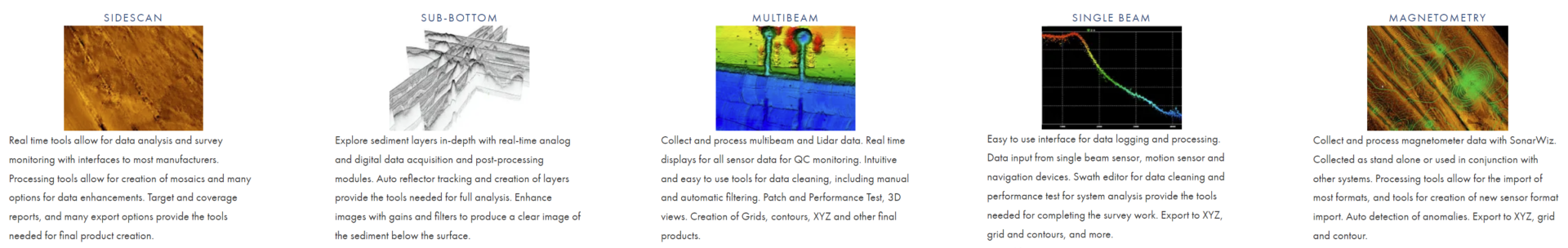
Factsheet: SonarWiz Magnetometer
Factsheet: SonarWiz Sidescan
Factsheet: SonarWiz Bathymetry
Factsheet: SonarWiz Subbottom
Factsheet: SonarWiz Single-Beam
Manual: SonarWiz